Activity Wales Events, a renowned sporting events company, proudly stands as the founders of the Long Course Weekend and Iron Man Wales. Set in Tenby, along the Pembrokeshire coastline, the Long Course Weekend takes place over three days and is the biggest multisport festival in Europe. The event continuously attracts an impressive crowd of over 12,500 athletes and 35,000 supports, from 56 nations!

The Challenge
The Long Course Weekend line-up includes the iconic Wales Swim, recognised as one of the UK’s largest open-water swimming competition, the Wales Marathon, the Wales Half Marathon, the Wales 10k and Wales 5k. Participants also have the choice of a gruelling 112-mile, 70-mile or 40-mile cycling course, weaving through the breathtaking landscapes of the Pembrokeshire Coast National Park.
All of these sporting events require the temporary closure of extensive sections of the road network to ensure the safety of the participating athletes, spectators, communities and other road users. However, this vital safety measure brings with it the challenge of significant disruption and delays for the travelling public and local businesses. This is further exacerbated by the influx of summer tourists in Pembrokeshire.
Key to managing the event, therefore, is efficient and effective communication. Regrettably, until recently, Activity Wales Events relied on a constrained, manual approach. The team’s process involved charting road closures and event routes onto static map screenshots which were then uploaded to the Long Course Weekend website.
This method proved to be both time-consuming and led to un-necessary duplication. Whenever alterations were required for closures or routes, the entire task had to be repeated and the map screenshot re-uploaded. Furthermore, the use of static screenshots meant the map lacked detail, making it more difficult for viewers to understand how the closures might impact their own journeys or work. This usually resulted in a large volume of inbound queries leading up to the event, as people sought more information and clarifications.
In preparation for the 2023 Long Course Weekend, Activity Wales Events aimed to transform their communication, ensuring that they could convey closure information effectively to the public and other stakeholders, both in advance of and during the event.
They turned to one.network for an easy, digital solution!
Key Outcomes
Reduced congestion on the road network during the event
with the power to communicate closures to sat-nav apps in near real-time
Decreased the volume of inbound enquiries received
from members of the public and local businesses in the lead up to the event
Enhanced safety for citizens, spectators and athletes
by ensuring detailed closure information was available online in advance and via sat-nav.
Minimised conflicts with road and street works
by providing a transparent, comprehensive overview of the event’s impact on the roads.
"It was important to us at Activity Wales Events to reduce the impact that Long Course Weekend closures have on the community. We wanted to improve how we plan and communicate disruptions so we can keep everyone safe and informed and ensure people can still get where they need to be in good time."
Activity Wales Events
The Solution
Thanks to one.network, Activity Wales Events was able to provide a seamless digital experience for the community leading up to and during the Long Course Weekend. The result? A notable reduction in congestion on the roads and a decrease in the volume of enquiries received.
Streamlined Pre-Event Planning & Communications
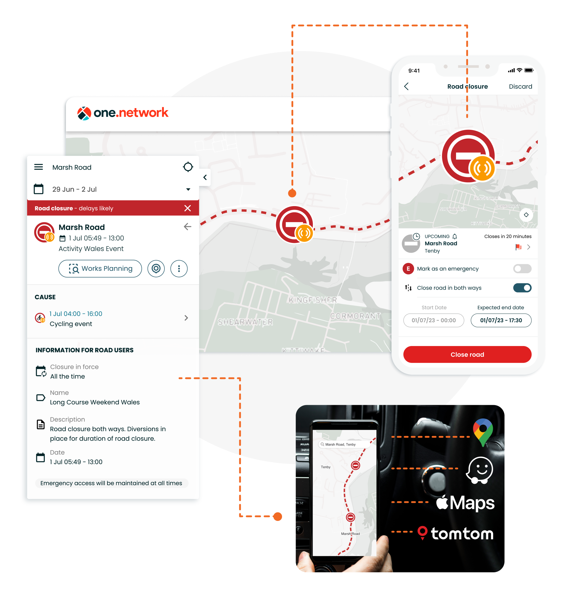
Working with Pembrokeshire County Council, Activity Wales Events planned, plotted and published all the closures for the event on the one.network map where it was easily accessible not only to the general public but also to local businesses, utility companies and contractors operating in the area.
Providing this detailed visibility of closures before the event on an interactive map gave the public the power to self-serve and better plan their journeys. This approach led to a substantial decrease in inbound queries compared to previous years.
Additionally, sharing all closure information on one.network allowed Pembrokeshire County Council and utility companies to coordinate their roadworks and avoid conflicts with the event schedule, reducing the risk of congestion build-up over the weekend.
By embedding the map into the Long Course Weekend website, Activity Wales Events also offered stakeholders a simple, quick and clear overview of the event’s potential impact on the roads without having to direct them to an external site or system.
Real-time closure comms for drivers
Throughout the Long Course Weekend, Activity Wales Events used the one.network Live Link mobile app to communicate closures to drivers via popular sat-nav apps including Google, Waze, Apple Maps, TomTom and Here Technologies.
With a simple tap on their mobile devices, the Activity Wales Events team could trigger road closures and relay them to navigation apps in near real-time. This ensured that drivers received timely notifications and were efficiently rerouted around closures.
Live Link provided them with the power to influence driver behaviour throughout the event, resulting in a significant reduction in congestion on the road network. It also enhanced safety for spectators and athletes by minimising instances of drivers attempting to navigate closed routes.
Operations Manager, Sarah Wills told us: “We definitely saw a notable improvement in traffic flow throughout the event. Sharing closure information on one.network and pushing it out to sat-navs via Live Link meant we were able to keep everyone informed and limit congestion to a minimum.”
A close collaboration between Activity Wales Events and first responders during the Long Course Weekend was also facilitated by Live Link. This meant that in the event of an emergency, a rapid road closure could be implemented and communicated, ensuring that emergency services could reach the scene as swiftly as possible.
