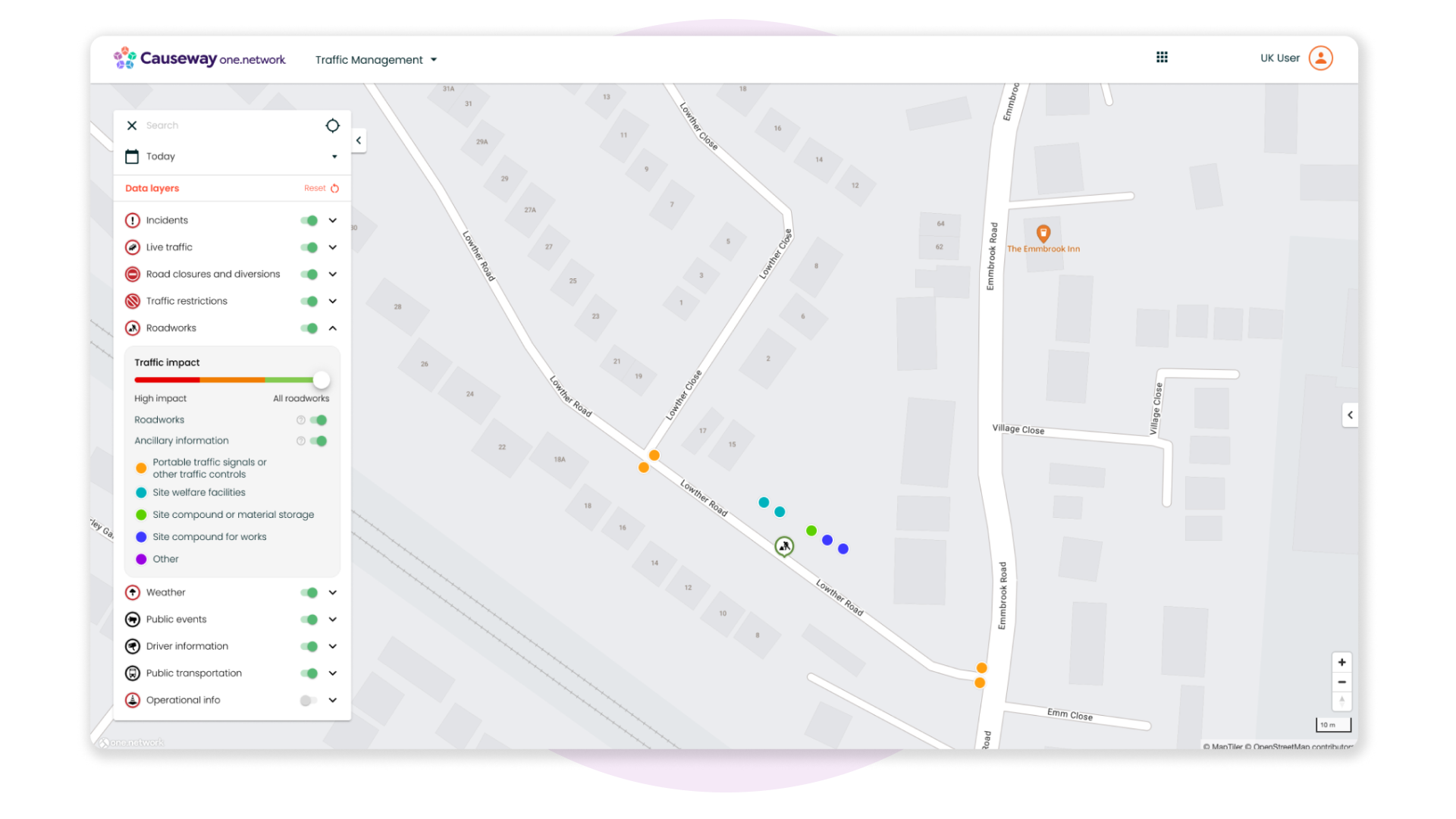
NEW: Ancillary Information Data Layer
Back in April, we introduced the 'Full Geometries' data layer, enabling you to visualise full geometries for all works and permits on Causeway one.network from the following systems: Street Manager
- EToN
- Scotland Street Works Register
- NTIS
- NOMS
Now, we are excited to share that we’re releasing another new data layer to help boost efficiency and streamline your workflow: Ancillary Information.
This data layer will pull through data from the same systems so that you can view ancillary information data directly on the Causeway one.network map.
You can access this new data layer via the 'Roadworks' data layer and it includes:
- Portable traffic signals or other traffic controls
- Site welfare facilities
- Site compound or material storage
- Site compound for works
- Other
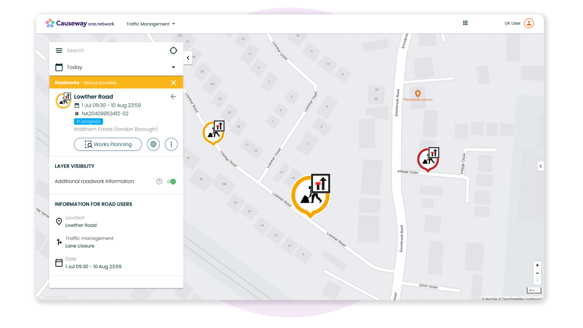
NEW: Causeway one.network Map Feature
We wanted to make it faster and easier for you to view and access the Full Geometries and Ancillary Information data layers anytime you need.
Now, when you click on a road event and open the callout box, a new toggle button will appear, allowing you to activate ‘Additional roadwork information’. By toggling this switch on, you’ll be able to quickly see full geometries and ancillary information related to that road event on the map.
If you have any questions on anything included in this release, please contact support@one.network.