Overview
In this release, we’re adding a new feature to our Traffic Management, Plan Share and Live Link solutions which allows for more accurate road event planning. Plus, we’re bringing you some additional improvements for Route Manager, Traffic Management and the Causeway one.network Map.
Let’s dig in.
New Road Level Responsibility Feature
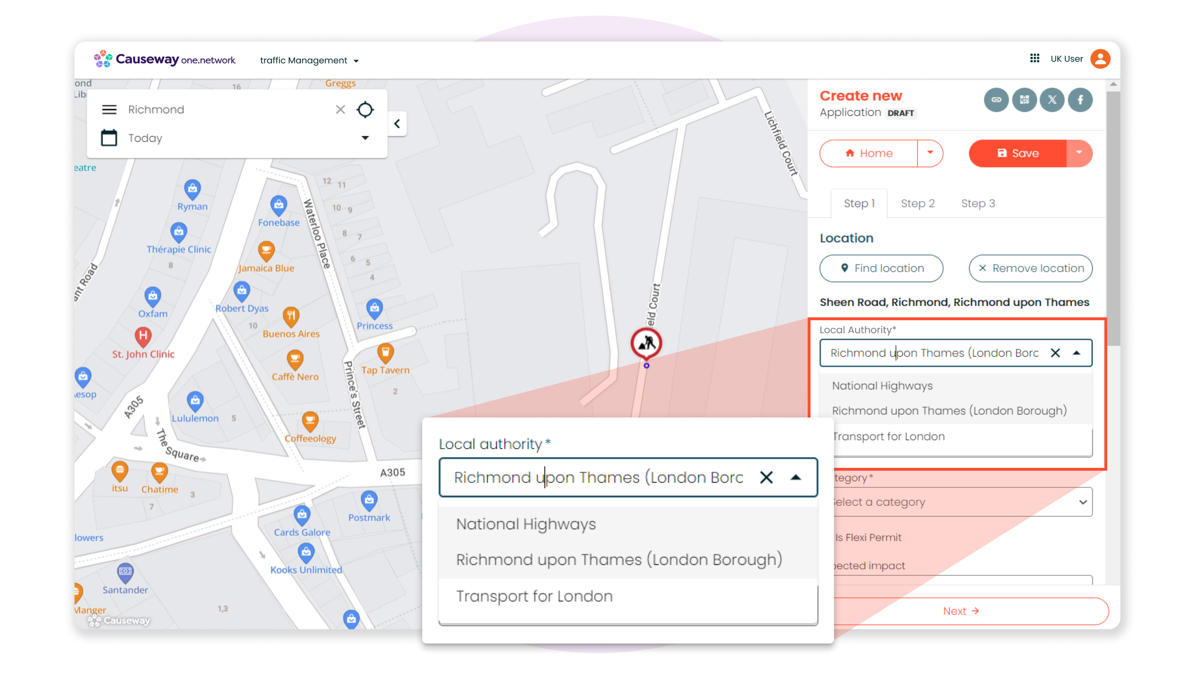
We’re introducing a new feature for our Traffic Management, Plan Share and Live Link solutions to help highway authorities more easily indicate whether a road event falls under the responsibility of the local authority or the relevant strategic highway authority.
Now, when you’re plotting the location for a road event, you’ll be provided with a drop-down list of options in the following scenarios:
- If your road event is taking place in the London area, you’ll be presented with the option to choose ‘Transport for London’ as the responsible authority.
- If your road event is taking place on or close to a road owned by National Highways, you’ll have the option to choose ‘National Highways’ as the responsible authority.
- If your road event is taking place on or close to a road owned by either of the Welsh strategic highway authorities, you’ll have the option to choose ‘South Wales Trunk Road Agency’ or ‘North and Mid Wales Trunk Road Agency’ as the responsible authority.
When relevant, this new option will appear at the top of the right-hand panel after you have plotted the location of the road event on the map.
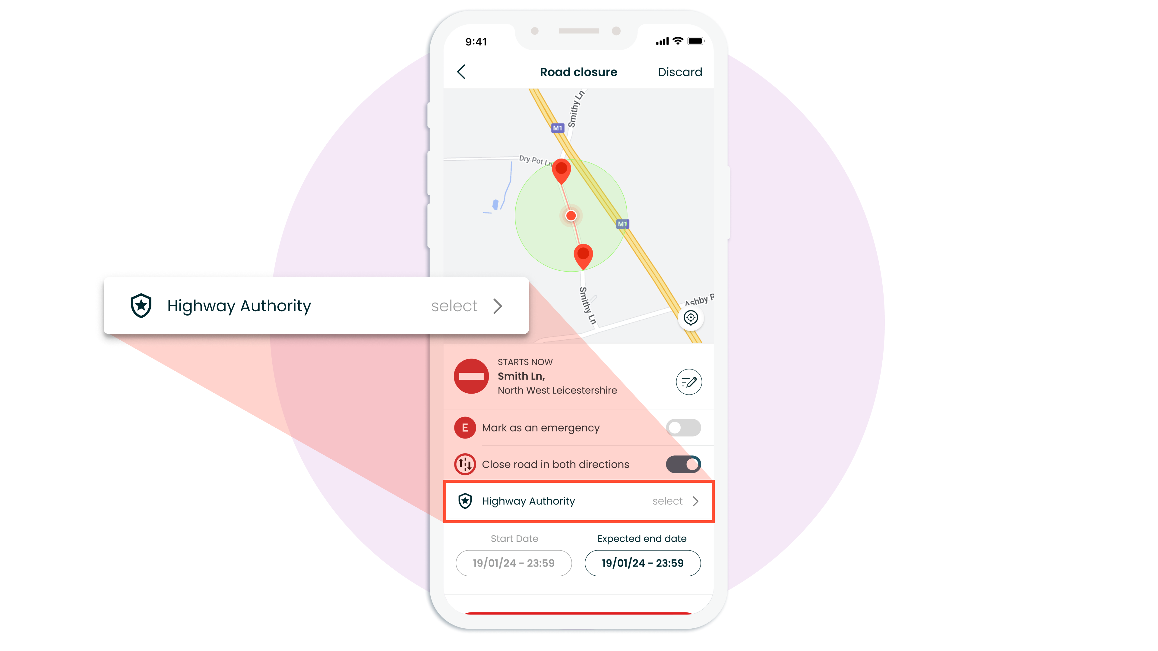
For Live Link users who plot road closures using the Live Link mobile app, you’ll see a new button that says ‘Highway Authority’ at the bottom underneath the ‘Close road in both directions' toggle. Tap on this to select the relevant authority.
NOTE: This change will be released to the Live Link mobile application on October 1st and will require you to manually update the app. Users will receive reminders closer to the time.
Whether you’re using Traffic Management, Plan Share or Live Link, the platform will auto-populate this field. However, when appropriate, you will now always be presented with the option to select a different authority.
Traffic Management
Other improvements for our Traffic Management solution include:
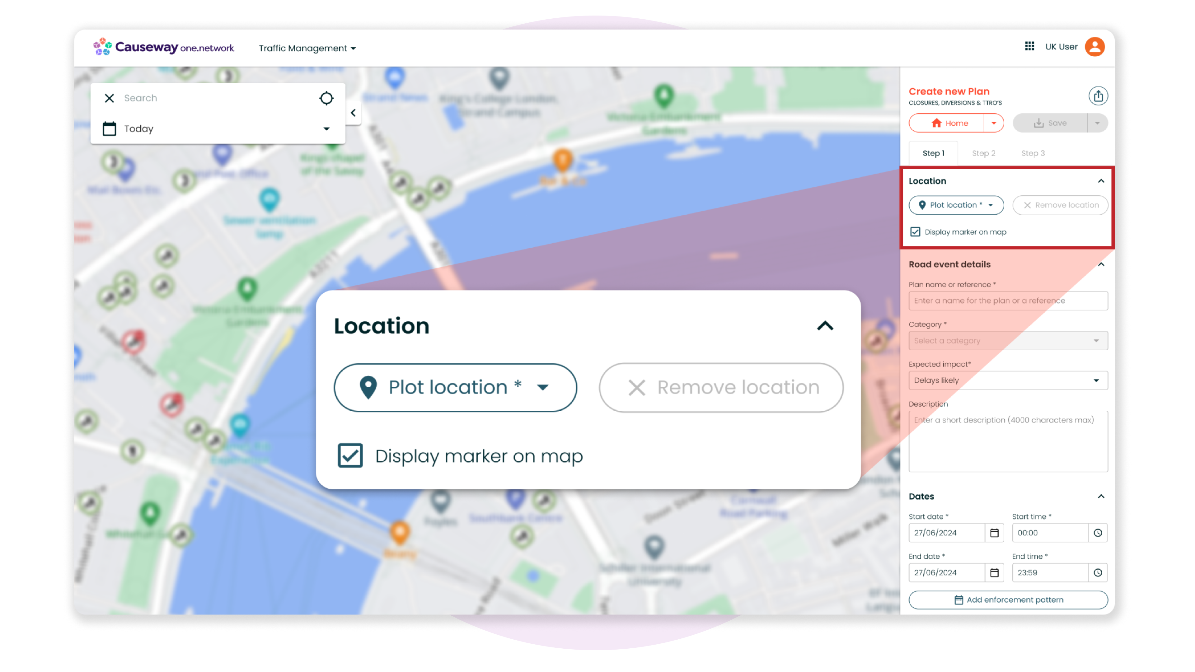
Rehoming the Plot Location button
In a previous release (e2.33.0), we announced that the 'Plot Location' button would be relocated to the top of the right-hand panel in our Traffic Management and Plan Share modules.
However, due to a technical issue, we were unable to implement this change at that time. We have now resolved the problem and are pleased to include the adjustment in this release.
This change is essential because upcoming developments to Traffic Management and Plan Share for the D-TRO initiative will require you to plot your location first, before continuing with the rest of the traffic management plan.
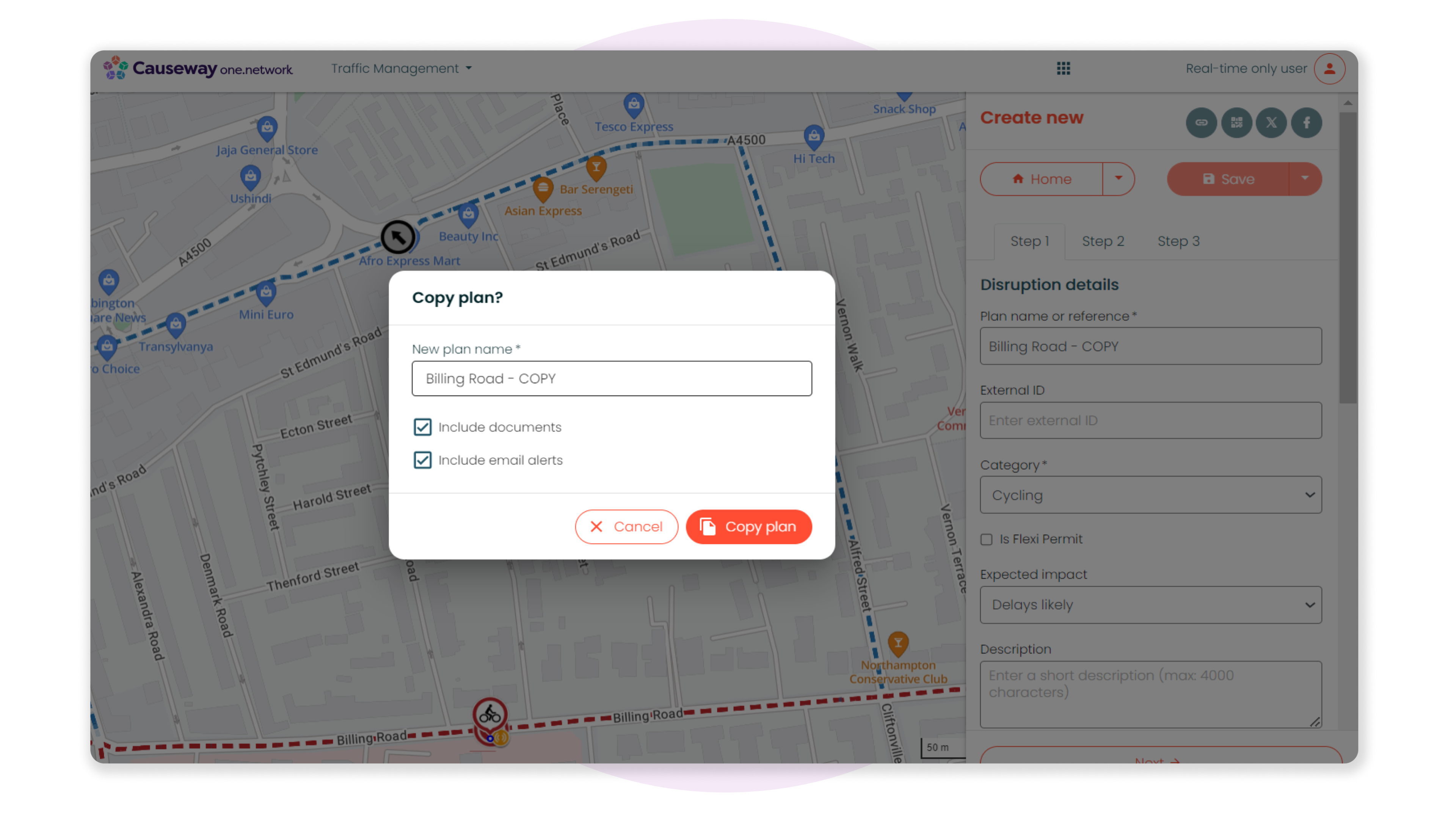
Greater control when copying Traffic Management plans
In the past, copying a Traffic Management plan automatically included the email alerts and documents linked to the original plan.
Now when you choose to copy a plan, you can decide whether to include these email alerts and documents in the new plan.
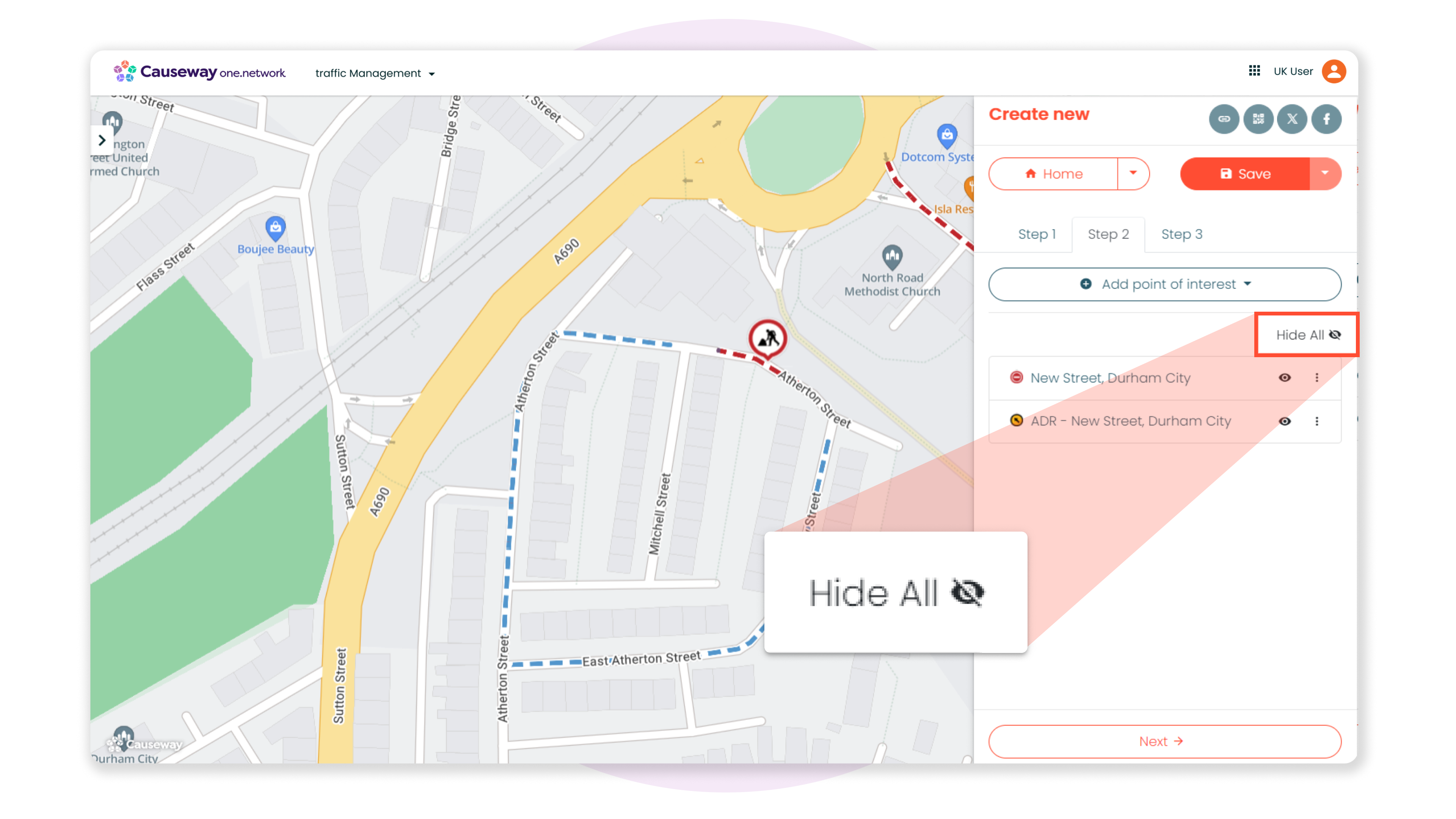
New ‘Show All/Hide All’ Button in Step 2
We’ve added a new ‘Show All/Hide All’ button in Step 2, enabling you to effortlessly toggle the visibility of all Step 2 items plotted on the map for that traffic management plan.
NOTE: If you are trying to isolate and view a single, specific Step 2 item, you will need to toggle on/off the relevant data layers on the Causeway one.network map.
Causeway one.network Map
Private Street Notices on Causeway one.network
Private Street Notices submitted on Street Manager will now be visible on the Causeway one.network map, offering you a more complete and comprehensive view of network activity.
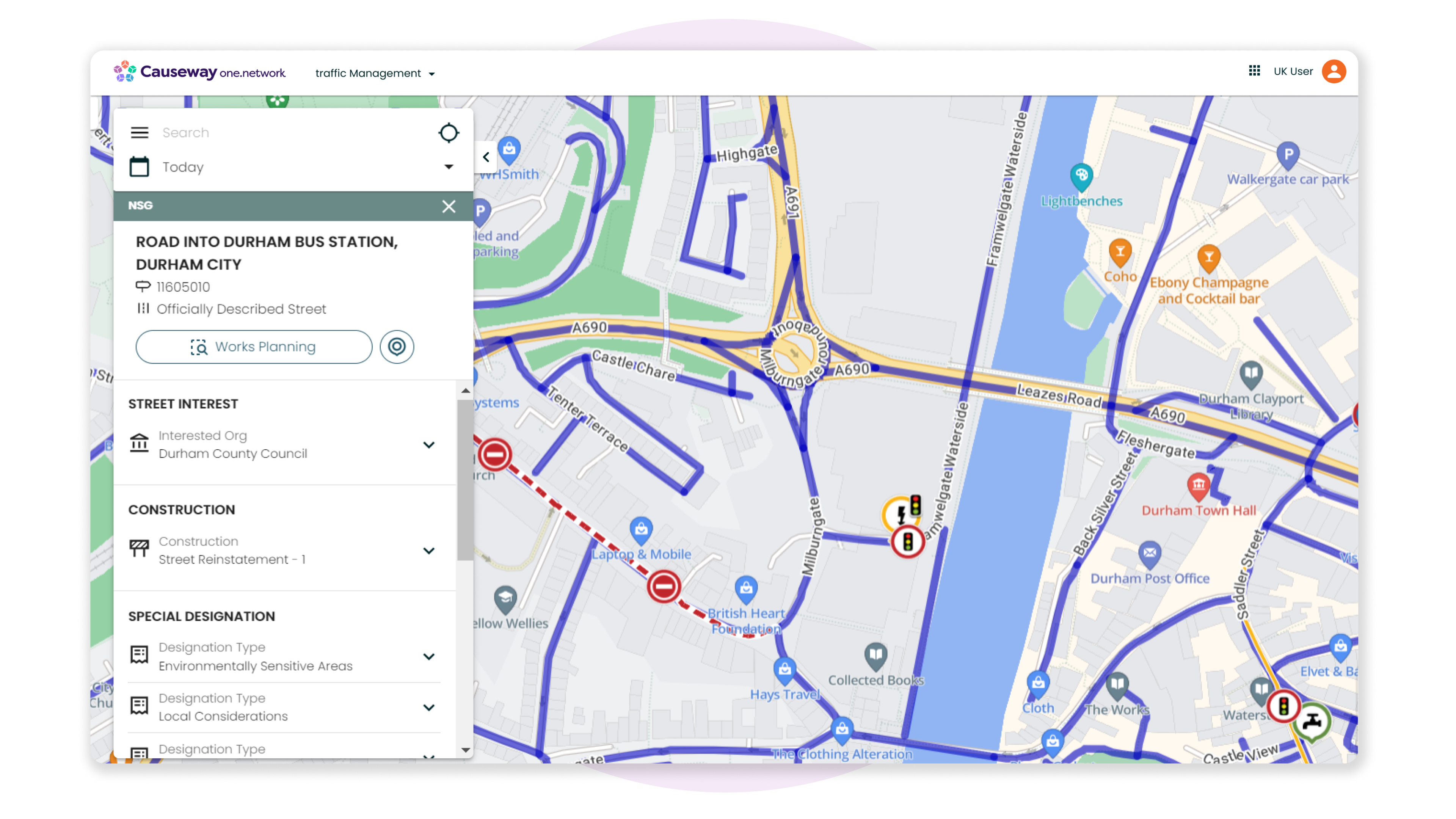
An improvement for NSG data visibility
If your organisation holds a Pro or Essentials subscription for Causeway one.network, you will have unrestricted access to all operational data layers on the map, including NSG data.
Previously, accessing detailed NSG information required clicking a link on NSG callouts that redirected you to an external page. Now, you can view all NSG details directly within the callout on the Causeway one.network platform, enhancing your experience and efficiency.
Route Manager
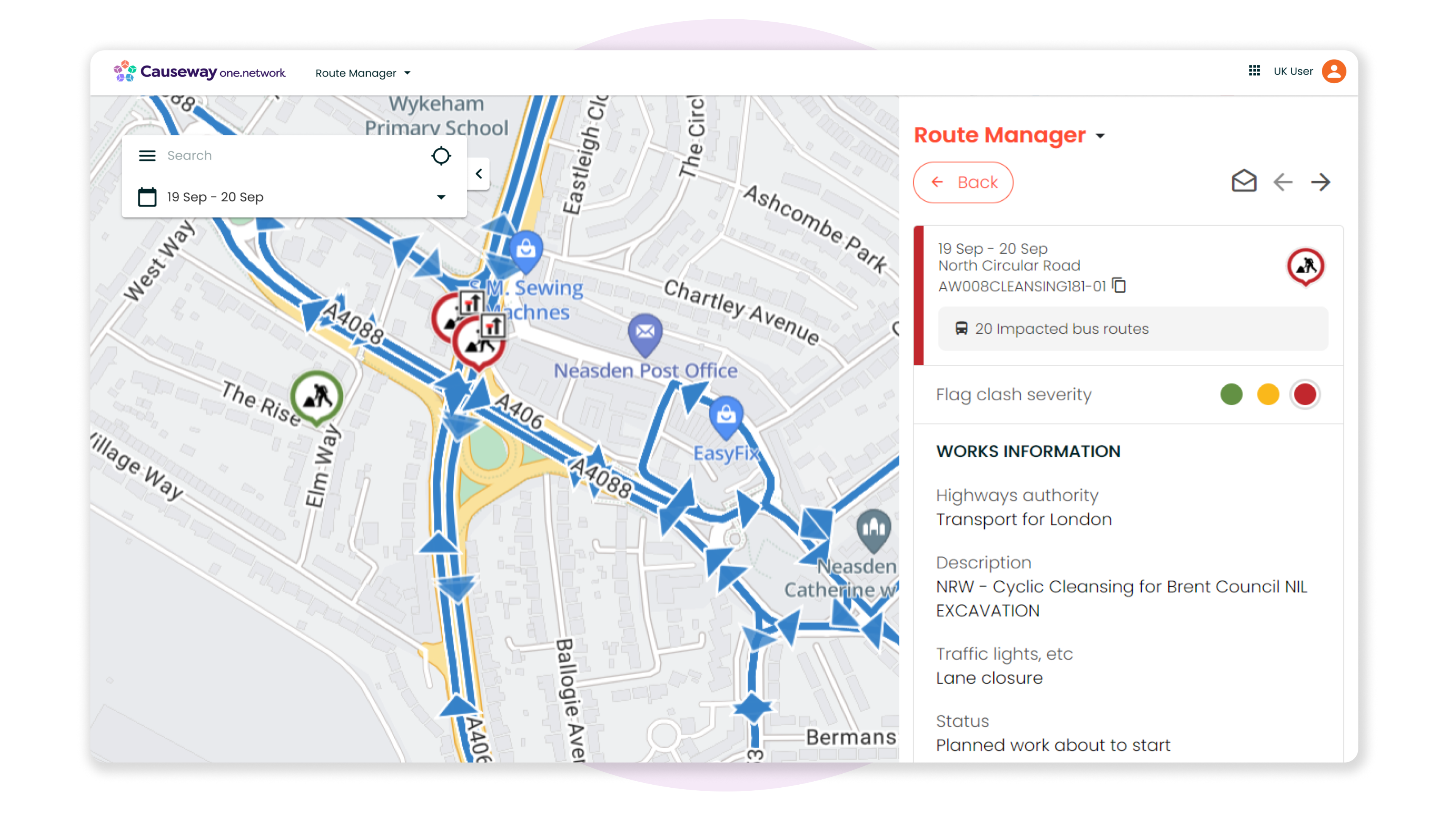
Our bus route management solution, Route Manager, enables local authorities and bus operators to visualise bus routes on the Causeway one.network map and receive automatic alerts about clashes between roadworks and bus routes. Changes to routes can be planned and shared across teams and organisations, providing a real-time view of the impact on traffic flow and streamlining collaboration.
In this release, we’re making a small improvement to the UI, so that when you hover over or select a bus route from the route or clash details screen, the selected route will be highlighted on the map, while all other routes will become less prominent.
This enhancement allows you to easily identify and concentrate on the specific route you are working on, minimising confusion and boosting your productivity.
That's everything for this release! If you have any questions about anything included, please contact help.desk@causeway.com.